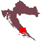
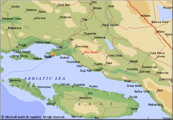
Sitno is located at the eastern part of the
Split area. This is an area of ancient Poljica, where the Poljica Principality lasted for centuries.
The village lies in the western part of the middle Poljica, and, according to The Statute
of Poljica, it is one of twelve main Poljica villages - so called katuni.
Sitno is bordering these villages:- in the north Dugopolje, Kotlenice i Dolac Donji
- in the east Dubrava i Tugare
- in the south Srinjine
- in the west Zrnovnica.
According to the census from 1991, Sitno Donje had 300 inhabitants, while Sitno
Gornje had 297 inhabitants. Population is growing, and according to the
last census (2001) Sitno Donje had 314 inhabitants, whilst Sitno Gornje
had 346 inhabitants.
The Poljica Principality extends southeastwards of Split, around the
Mosor Mountain, which extends across
Poljica like a 27 kilometer-long spine (map of Mosor).
The highest peak in the west is Veliki Kabal (Ljuti kamen-1339 m), and in the east it is
Sv. Jure (Kozik-1319 m). Near the Poljica coast two mountain branches extend, Sridivica or
Markovaca (from the Zrnovnica river to village Srinjine, with altitude of 433 m), and
Vrsina (from the Zrnovnica river to the town Omis, with a length of 17 km, and a height up
to 584 m).
The Cetina river surrounds Poljica from the town Trilj to the river mouth. The length of
that border is 50 km. The northwest border of the Poljica Principality is the most
difficult one to determine. The Statute of Poljica
(from 1482) determines that border using several important geographical points across the
Mosor Mountain, connecting two rivers (Zrnovnica and Cetina). This is an original
quotation concerning the border from the Statute (in Croatian):
"Počimljući od zapada i od mora di stecaet se rika Žnovnica,
uz brdo prvo Stojni Kamin, pod Kaminom uprav k moru, a gori uz riku
Vrilo Žnovnice, uprav Pećica, granica na Ošlji art, granica voda
Sedrenik. Peć u Krivica, granica Kučišća, granica u Konjevodu, granica
Trnova kamenica, granica Obišeni dub, kod njega granica Vladavića
dubrava, brdo Samolek, mali Konačnik, Cetina pod Gardun. Pak niz Cetinu
uprav izpod sela Čaporic, ispod sela Ugljani, niz Cetinu, ali posrid
rike u Blato od Radobilje, niz riku pod Kreševo, pod selo Katuni, sve
niz riku u Perućicu, pod grad Zadvarje, niz riku pod Slime u Kučiće, niz
riku pod Miric, Viseć, Medviju, niz riku prid grad Omiš. Pak u more, a
niz more do Stobreča aliti u riku Žnovnicu." |


